Again - that beautiful Friday - sunshine - clouds and a drive up Chuckanut. Chuckanut Drive a 20-mile road that connects the Skagit Valley to Bellingham. It is a much slower alternative to the whizzing fast traffic of I-5 - just the thing to complete our day. It winds along the coast and along the rock shoulder of the Chuckanut Mountains.
"Chuckanut" is a Native American word meaning "beach on a bay with a small entrance." The road was originally
completed in 1896 - but not paved, and was the first road to connect our county to the south. It brought in a new era of transportation and merchants could now market their products in Bellingham and return home all in the same day.
The road has some of the most difficult road-building terrain in the state due to its sheer cliffside, which made it a less-than-ideal location for a highway. Paving the road had to be done in stages because there was no funding left after the road was laid out.
Convicts from local jails worked on the road and it was completed in the early 1920s, with plenty of stone guardrails and stone bridges. At some places you could reach out and touch the massive rock cliffs that line the road - and it is often so narrow that two normal size cars slow down when approaching each other to avoid hitting the rock cliffs - or the rock retaining walls. The road curves in and out of the forest - with amazing views of the San Juan islands and the bay.
Boulder table and benches - I think you should bring a cushion or two for the picnic . . .
The road has some of the most difficult road-building terrain in the state due to its sheer cliffside, which made it a less-than-ideal location for a highway. Paving the road had to be done in stages because there was no funding left after the road was laid out.
Convicts from local jails worked on the road and it was completed in the early 1920s, with plenty of stone guardrails and stone bridges. At some places you could reach out and touch the massive rock cliffs that line the road - and it is often so narrow that two normal size cars slow down when approaching each other to avoid hitting the rock cliffs - or the rock retaining walls. The road curves in and out of the forest - with amazing views of the San Juan islands and the bay.
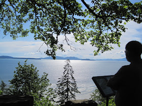
View from the cliffs above the bay . . .
Looking north . . .
The gravel beach is actually the railbed for the trains that travel this route - between Seattle and British Columbia. This is the route that Amtrak takes - beautful views of the bay from the train.
Another view of the bay with fairies dancing on the water . ..
Lookin towards Anacortes . . .
Islands and clouds . . .
Almost more breathtaking views than you can take in . . .
Don looking out over the bay . . .
Boulders to keep you from driving off the cliff . . . a good idea . . .
This tree is trying to step over a very large boulder . . .
This huge boulder sits across the road from the view point where we stopped. The plaque says "Dedicated to the Memory of Governor Lister - by the Women's Improvement Club - Edison, WA". There is no date - he was governor from 1913 to 1919, when he passed away. Governor Lister was instrumental in using honor convicts from Washington prisons to work as servants in his home, helping them to earn money to be used on their release from jail. It was a successful experiment, and convicts were also used to complete the paving of Chuckanut Drive. 


I know this road! :-) It's so beautiful!!!
ReplyDeleteI didn't know the history though.
The views are stunning, hard work by the convicts finishing the road. I plaque is a wonderful idea. Thank you for leaving a comment on my post, and to answer your question; yes I do quilt. Have a wonderful day.
ReplyDeleteGosh...so beautiful - must be what heaven will look like.
ReplyDeleteI've always wanted to make that drive and now seeing your pictures I definitely need to see the Chuckanut Drive. Thanks for sharing.
ReplyDeleteMemories of teen years, when we used to take a drive down Chuckanut - thanks for bringing them back alive! Maybe it's time for a real drive down memory lane.
ReplyDeleteLovely pictures! Although we were through several parts of WA in the semi, of course we couldn't get this far out :) I love the picture of the "boulder-hugging tree", and i zoomed in on the water fairies, and yes I believe I could actually see them dancing!
ReplyDeleteGORGEOUS! I can't get over the views there. They are amazing, and that was an interesting story about the building of the roads there.
ReplyDeleteWishing you a Happy Memorial Day and thanking you so much for making Mr. Magpie's birthday so happy with your greetings! He appreciates it, and I do, too! I'll see you when I get back from a very quick little blog break this weekend. I'll be back before you even know I'm gone! ;-)
XO,
Sheila :-)
Beautiful!!! Thanks for sharing.
ReplyDeleteLove the pix of Chuckanut Drive. You tell such a wonderful story with your pictures. Thanks for sharing them.
ReplyDeleteIt looks so much like our part of Maine there, I really had to blink my eyes when I saw these pictures! So many similaries, right down to the granite boulders aligning the side of the road. Great images Jo! ~Lili
ReplyDelete